
Tag Archives: md Mapper1000DG
Drones & Surveying Flood Zones
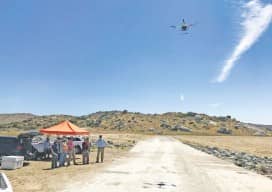
In Juniper Flats, CA, county land surveyors use UAS to save tax dollars and project times and to improve public safety. Photo above: Steven Lewis, Trish Ortega, Paul Clements, Claudio Padres of RCFC & WCD; Sebastien Borghini of Microdrones; Dan McMahon of Allen Instruments. Joshua Tremba does a lot of mapping; he’s the supervising land surveyor...
