
All posts by Patrick McGranaghan
Hayden’s Survey in 3D
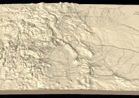
Above image: Hayden’s triangulation survey map is overlaid on a digital elevation model. A GIS project visualizes the fascinating triangulation network created for the historic Hayden survey of Colorado. One of the great surveyors in the American West is undoubtedly Ferdinand Vandeveer Hayden. A physician during the Civil war, he rose to be chief medical...
